volume
25/01/2016
•
123 cm

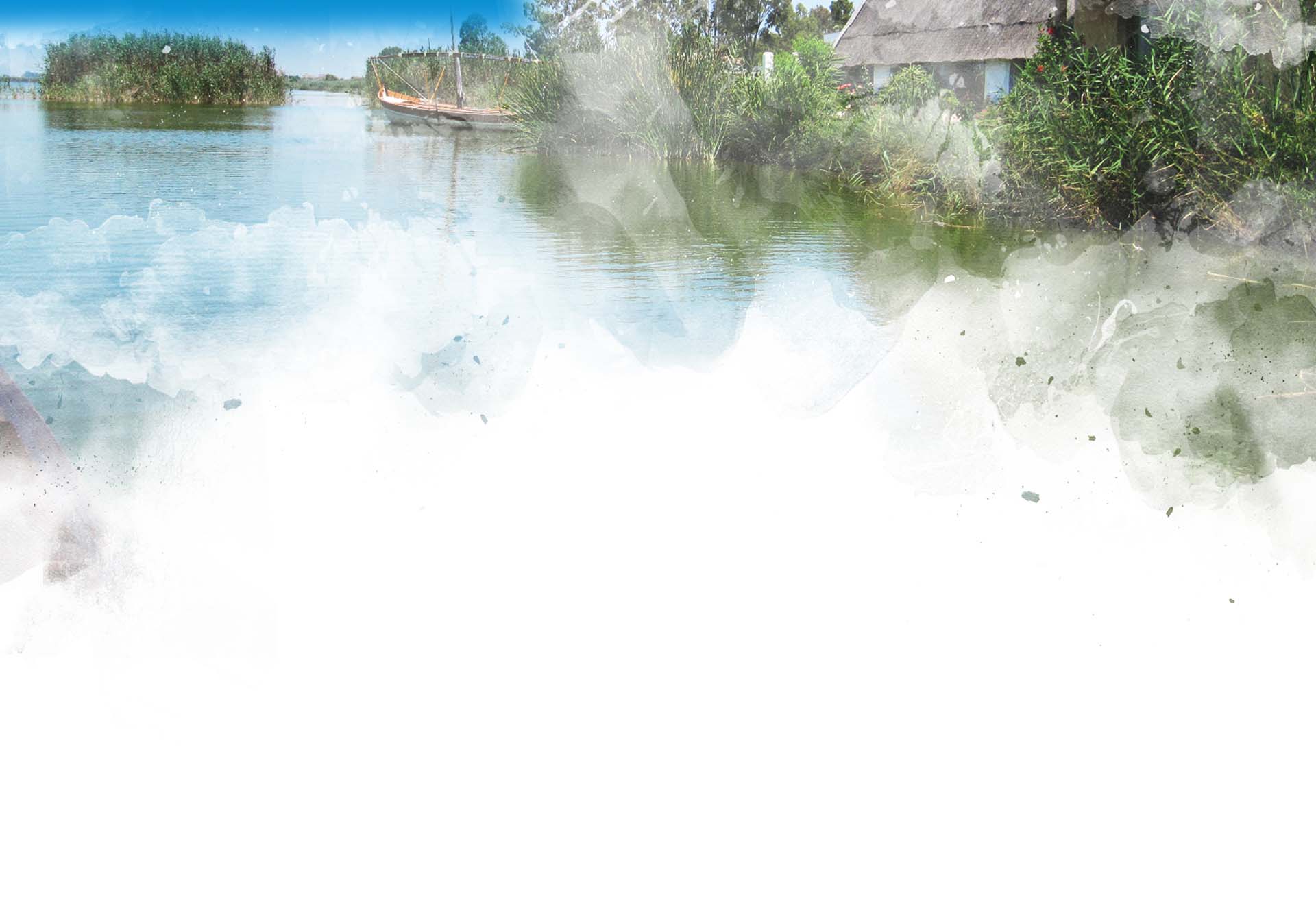
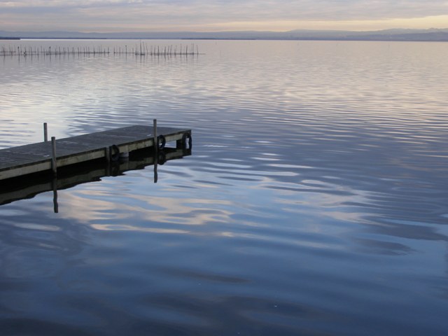
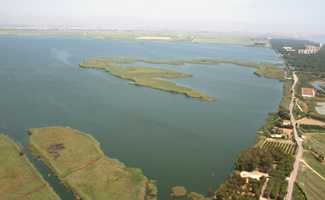
The lake of l'Albufera is as amazing nowadays as it once was for the ancient Roman or Arab settlers. It covers practically the same area as that of the entire city of Valencia (2,100 hectares) and reaches a maximum depth of a mere 1.5 metres.
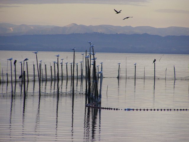
The water on l'Albufera is freshwater, since it comes from the rice fields surrounding it, which, in turn, are fed by the Jucar and Turia Rivers. The lake pours its waters into the sea through several golas, or man-made canals that are controlled by sluice gates, passing through the Devesa forest, which separates l'Albufera from the Mediterranean Sea. Although it is well known among humans, it is even more so among birds. Thousands of them come every year as part of their migratory routes. The Matas are made up of several wetland thickets in the natural shores between the lake and the rice fields, constituting are a unique shelter to rest, feed, find a mate or breed. However, this wealth of biodiversity is under pressure because it is surrounded by a major metropolis with over one and a half million inhabitants. Its eutrophic waters (heavily loaded with organic matter) prevent it from reaching its enormous ecological potential. For this reason, the efforts made to protect it and improve the quality and quantity of water that feeds it are increased year after year. If you wish to know more about l'Albufera, there are more surprises yet to come...
The rivers that have run around and alongside l’Albufera for thousands of years dragged materials into the sea. The sea carried them by current and deposited them until a sandbar or sandspit was formed between the estuary of the Turia River and the mountain of Cullera, creating an isolated marine gulf, thus creating l’Albufera as it first was.
Given its marine origins, we could assume that its water is still saltwater; however, it is now freshwater. How did this change happen? What was the original l’Albufera like? Were there any Matas or thickets as we can see nowadays? Was rice grown? When we stop to think, many questions come up.
L’Albufera was a lagoon the size of which was larger than that of the entire current protected area of the Natural Park!
The lagoon was constantly connected to the sea through a natural inlet or gola, which is why saltwater flowed unhindered. The brackish water of l'Albufera remained in existence until the 18th century. In those times, the lake and the forest that separated it from the sea (the Devesa forest) were exploited for fishing, hunting, salt production (there were salt marshes located in the Racó de l’Olla area) and stockbreeding, which made the most out of the green pastures surrounding the lagoon.
However, rice farming gradually took over. By late 18th century and throughout the 19th century, this type of farming experienced a boom, since large amounts of freshwater reached the area through the Royal Irrigation Channel from the Jucar River to be used in this activity. Matas, the local name for the shores and thickets, started to appear, made up of freshwater plants.
Since the area used for rice farming increased more and more, the size of the lake was likewise reduced because of the earth dams created. However, in 1927, King Alfonso XIII gave l'Albufera to the people of Valencia. Now, l’Albufera has 3,114 hectares compared with the 30,000 it initially had.
What is the status of l’Albufera now? It is protected as a Natural Park, isn't it?
Although in the last two paragraphs we have described 6,000 years of history, it was the last 50 years that had a disastrous effect on the Lake.
The 1960's and 1970's were dark times for l'Albufera. Urban clusters and industrial parks built nearby dumped their wastewater directly into the lake. In addition, there was an increase in the use of pesticides and weedkillers in agriculture in the area. All of this meant that, in just a few years, l’Albufera went from having clear water with a wide range of plants and animals, to having murky green water (due to the proliferation of phytoplankton) from which aquatic plants and many animal species disappeared.
These were the conditions of l’Albufera when it was declared a Natural Park in 1986, together with the 14,000 hectares of rice fields surrounding it and the sandbar (restinga) separating it from the Mediterranean Sea.
At present, city and industrial water treatment systems (treatment plants, sewers) are being improved in order to prevent poor quality water from reaching l’Albufera.
In addition to the problem of the quality of the water, there is that of the amount of water. We must not forget that l’Albufera is located at the mouth of the Jucar River basin. The lake is fed the excess water from use in the rivers flowing into it. Speaking about excess water is quite optimistic if we consider that there never is plenty of water but rather there always is a shortage of it.
Replacing traditional irrigation, namely flood or “surface” irrigation, with drip or “trickle” irrigation, in the fields watered by the Jucar River, has involved a great reduction in high quality water inflows reaching the Natural Park (in drip irrigation there is no excess irrigation), especially if we consider what the inflow from the Jucar River has meant to l’Albufera, from late 18th century to the 1980's, accounting for more than 85% of all the water fed into the system.
L’Albufera is in urgent need of a new inflow of quality water (environmental flow) in order to regain the clarity and transparency it once had.
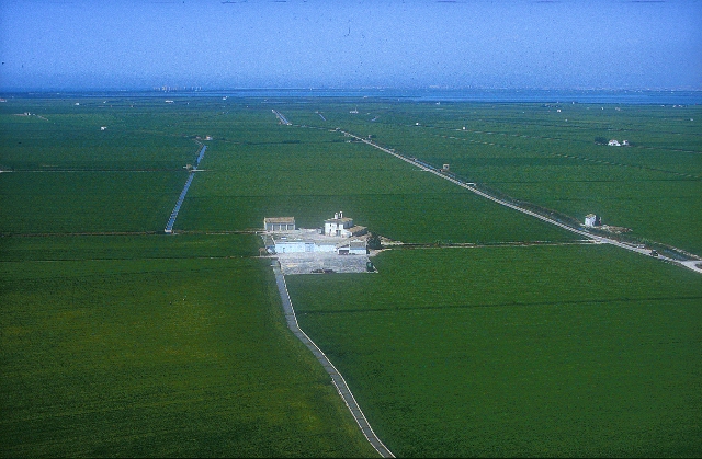
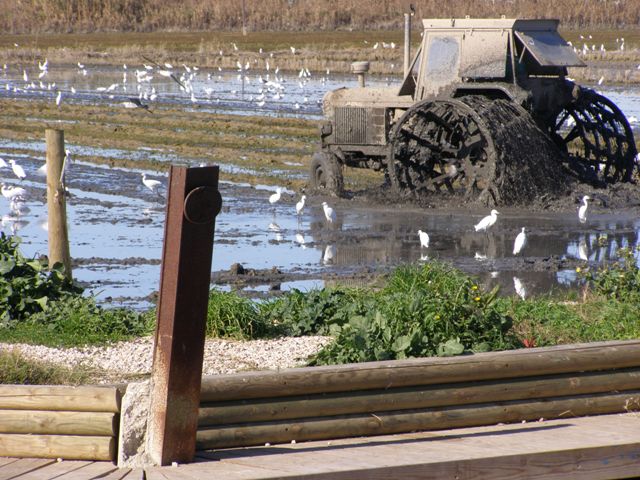
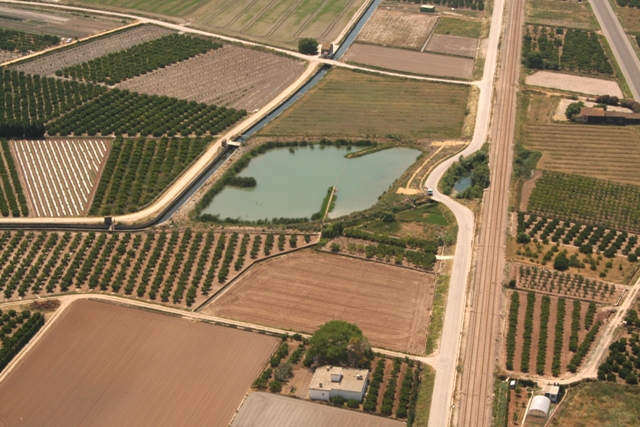
To talk about the marsh is to talk about rice fields; 14,100 hectares of l'Albufera Natural Park are used for this crop. Farmland, paths, irrigation canals and ditches cover over up to 70% of the total protected area. The ever-changing landscape in l'Albufera throughout the year is largely the result of the varying rice-growing phases of the rice fields: green tones in summer, blue in winter and brown during the periods when the land is bare.
These rice fields are valuable not only in economic terms measured by the profitability of the rice crops, but also in terms of the biodiversity and landscapes it provides. In fact, its protection status as a Natural Park was awarded because the activity carried out by its people is compatible with nature conservation.
Rice fields may be seen to be temporary aquatic habitats holding water in summer, when many natural aquatic eco-systems are dry. Many animals use the canals and rice fields as a place to feed, breed or shelter. Summer strolls around the marsh means coming across all kinds of coots, moorhens and herons.
Being able to admire the vast agricultural landscape while next to a city is a luxury that we should learn to appreciate. It is a place where an important economic activity for the local population is developed and where tradition and technology coexist.

Most rice fields consist of land taken from l’Albufera over the years in the 19th and 20th centuries. After purchasing or leasing a section of the lake, a tancat, or plot of land, is created by demarcating the plot through the creation of a dike built up above water level, also known as a mota. Then, more muddy earth is added, taken from a shallow area of the lake, until the area is filled up to the top and level with the neighbouring fields. All of this arduous work was done with rowboats, hoes, grass baskets and great effort. Once the tancat was isolated, it was possible to control the water level inside it by using mechanical pumps, which were originally run by steam engines. Evidence of this past can be observed in the brick chimneys that remain in some of the old engines. Currently, most engines are electric-powered engines and water regulation within the tancats is automated.
Not only are the tancats irrigated with water from l’Albufera, but also the highland rice fields (la marjal alta) are irrigated with water from the Jucar and Turia Rivers. In all those cases, irrigation is carried out collectively depending on the requirements of rice.
In a tancat, the rice growing cycle begins with the Perellonà, a period running from November to January. During this time the entire marsh is waterlogged, the sluice gates are closed and the water level on the lake and the tancats is levelled. In January the sluice gates are opened and water is pumped out aided by engines in order to empty the fields so that the soil can be worked and levelled. The fields remain dry until late April when they are flooded once again in order to begin rice farming. Planting begins in early May, with round grain seed varieties, such as "Bahía", "Senia" and "Bomba", mainly. Up until the 1960's, direct plantation was not yet in place, so rice seedlings were transferred from the planters (areas where rice was planted and kept from March to May when it had grown up to 20 cm tall) to the permanent fields.
During the first fortnight of August, the fields were re-emptied in order to begin the rice harvest. The rice crops were picked by means of a harvest machine in the months of September and October. Having removed the rice stalk from the fields [Rice Stalk], November marks the beginning of a new Perellonà, the fields are flooded again and so winter will go by with waterlogged fields sheltering numerous birds.
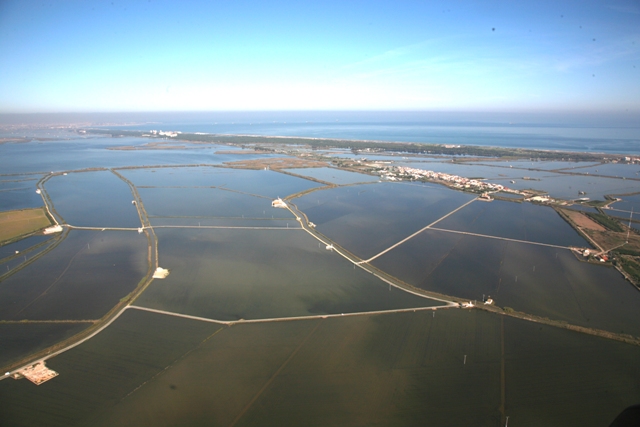
Depending on rice farming needs, the tancats must be regulated in terms of the water flowing in from l’Albufera. Such regulating is managed by the Junta de Desagüe de la Albufera [Sewer Board of l'Albufera], which is an autonomous body in which “every owner of land located within the old borders of the lake” (defined as per the landmarks put in place in 1761) is involved and which is governed by Internal Rules and Regulations dating back to 1926. Water levels on l’Albufera are regulated through a sluice gate system situated on three man-made canals, generally referred to as golas. These golas are called Pujol, Perellonet and Perelló.
After l'Albufera was declared a Natural Park, a series of measures have been implemented towards reducing the negative impact of agriculture on the surrounding areas (transformation and reduction of natural habitats, agricultural practices such as the burning of stubble, urban development, construction works and foundations of banks and canals, etc.). These measures include the need to make traditional economic activities compatible with the conservation of natural eco-systems and their ecological and cultural wealth.
In addition, many of the conservation measures applied have been established by the European Union through the approval of two Directives and accompanying environmental measures derived from the Common Agricultural Policy (CAP). The entire rice farming area of the park has received economic aid packages of this sort, which play an integral role in safeguarding the source of income of the farmers.
If you want more information, go to:
www.eco-rice.net. The Life Eco-Rice Project
www.albuferadevalencia.com. Regulations Guidebook for the Life+ Environmental Seduction Project
Ullals are underground water springs located in the marsh. Usually surrounded by rice fields, they form small lagoons that have gradually been reduced due to farming activities. The high quality of the water in the ullals has meant that currently these provide shelter and act as a reserve area for the freshwater flora and fauna that used to occupy hundreds of hectares in the Natural Park.
They are, in sum, a reminder of the days in which the lake covered all of the present-day rice fields.
Two examples of these ullals, the Baldoví and Sants springs, can be found in the vicinity of Muntanyeta dels Sants in Sueca. They were restored as part of the Life Ullals Project.
If you want more information, go to:
www.cth.gva.es/lifeullals. Life Ullals Project.
www.cma.gva.es/comunes_asp/documentos/agenda/cas/tripticocastellano.pdf. Information pamphlet about the Life Ullals Project.
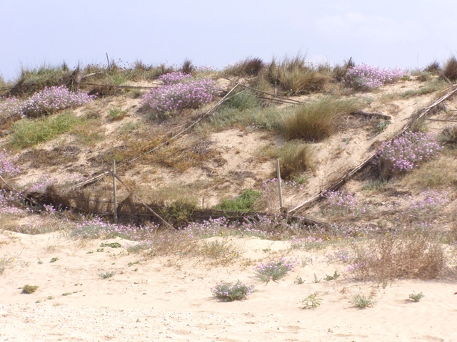
Although everyone knows of l’Albufera, the Devesa, in turn, is virtually unknown. The lake dates back 6,000 years, and so does the Devesa. L’Albufera exists only because the Devesa exists too, as it separates it from the Mediterranean Sea. If l’Albufera is a unique lake, the Devesa is a unique, and the only, place to enjoy the dunes.
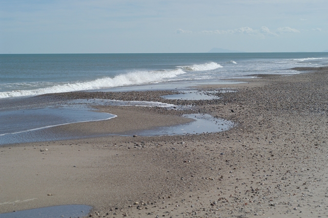
From the new estuary of the Turia River as far as Cullera (northern and southern borders of the Natural Park) there are 30 km of sandy coastline where the greenery of the Devesa stands out from among the buildings, apartment blocks, promenades and marinas.
Strolling through the Devesa, we can see all the different eco-systems, areas characterised by the existence of plants and animals that are adapted to the harsh conditions of the soil, temperature, humidity, etc., from the dune-ridden beaches, through grasslands and waterfront reedbeds, to an impenetrable forest of vines, shrubs and trees.
The beaches The Dunes The fixed Dunes The dune slacks
At present, there are beaches for all kinds of visitors with various needs: some can be accessed by vehicle and others only on foot. Some have first aid huts, showers, and umbrella and beach chair rental services, whereas other, more unspoilt, beaches are difficult to access and lack these services.
Every beach is unique as are its users... thus we all have our personal preference.
If, however, when we visit the beach, we only think about enjoying ourselves but forget about the rest, we might leave a mark that could be hard to erase. Whenever we visit the beaches of l'Albufera, we must remember that we are in a Natural Park and we must look after them in the same way any such fragile environment deserves to be looked after.
Have you ever considered that, in order to find our beaches clean every day, these must have either not been polluted at all or been cleaned out first thing in the morning? That the water used in the showers is drinking water and that when you get home, you will shower again? That when sand dries, it falls off and is easy to clear off?
Carry a bag with you when you got to the beach so that you can put rubbish in it that you may have generated while you were there and then throw it away in a bin. If you smoke, you will also need an ashtray. Use the paths and avoid walking on the dunes or pulling up little plants (even those that seem insignificant are of great value).
You can see that the further south of the Devesa you are, the more unspoilt the beaches are too. Here we must be most careful. The area subject to the utmost level of protection is the Integral Reserve Area called "la Punta", which has restricted access and where not even sand clearing is carried out so that birds, such as the plover, may feed, as they depend on insects living off traces on the seashore.
Dunes are created in two ways:
- By allowing nature to operate. The wind will carry sand for years, accumulating sand around an obstacle (for example, vegetation) on the beach. The "mountain" will grow and more vegetation will appear, which will trap more sand...This is how the dunes of the Devesa were formed some 6,000 years ago.
- By allowing machines to operate. The machines accumulate the sand available, shaping the mound of sand so that it resembles the shape of an actual dune. Then, numerous workers will seed and plant vegetation that will grow until a natural dune is achieved. This is how the dunes that were destroyed in the Devesa because of urban developments have been regenerated in the last twenty years.
In the Devesa, the dunes that nature took so long to craft were flattened down by people in just a few years (Urban Development Project in the Devesa, of 1970) and now those people are re-forming them (Life Dune and Life Enebro Regeneration Projects).
The dunes, located in a zone that acts as a buffer between the beach and the pinada, are very fragile eco-systems where both animals and plants have adapted to life in dry and windy conditions. In addition to its great value in terms of biodiversity, they are crucial to the conservation of the Devesa forest, blocking the wind that could cause the pine trees to burn as the first line of defence.
Our suggestion... When you go to the beach, go towards the nearest dune, make yourself comfortable and watch the leaves, flowers, stems and roots of the plants you see around: they are in the tracks and trails left by beetles going up and down the dune. You will be amazed!
Now, remember that these dunes are not for you to lie down in an area sheltered from the wind, or for you to run or roll down either…
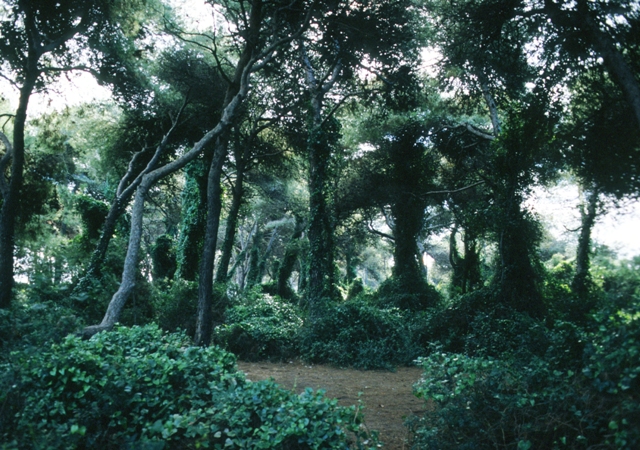
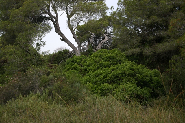
Behind the beach and dune zone, there are fixed dunes. These are the oldest dunes of the Devesa and although they are known as “la pinada” (pine grove), there are no pines. Crossing or walking through the jumble of shrubs and vines that grow beneath the pine trees can sometimes prove to be difficult: thick shrubs, sometimes growing overhead (with green leaves for the entire year and mostly bearing berry-like fruit resembling small red, black and orange colour balls), get tangled up with vines of heart-shaped leaves (sarsaparilla) which climbs up the pine trees creating impenetrable prickly thickets. Even so, it is easy to find a spot to enjoy the shade and cool breeze in the summer, or shelter in the winter.
Strolling along the paths you can see animals such as rabbits, partridges, wood mice, snakes… and, with a bit of luck, perhaps even a genet. Great! There is a large colony of this species of giant cat that inhabits the Devesa, since the times when the Arabs brought them as pets. If they are not visible, you can search for pawprints and tracks, their faeces, traces of food, empty nests or marks in the sand or bones… Needless to say, it must be done with the utmost respect and care towards the animals and the area where they live.
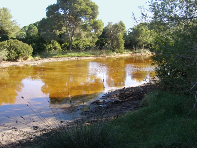
In winter, if you walk in the Devesa forest, you will see, through shrubs and trees, a large wetland area appear resembling a lagoon. In summer, you may stroll along in the same area, but the lagoon may no longer be there; instead, there is whitish sand that looks like salt. What is this? Where has the water gone? Moreover, what has happened?
You have just found a mallada or dune slack. Although the bottom is sandy, it is also muddy, which makes it impermeable. In winter it rains and the dune slack becomes flooded. In summer, however, the water is slowly evaporated by the sun until the dune slack dries up completely.
As it goes from flooded to dry, you can imagine that plants and animals living on the dune slack would have to be very special and very well adapted to these contrasting living conditions. These "clearings" in the middle of the forest, known as "Mediterranean Temporary Ponds", their technical name, are a morning meeting point for many species looking for a good breakfast. Shush! Do not disturb them!