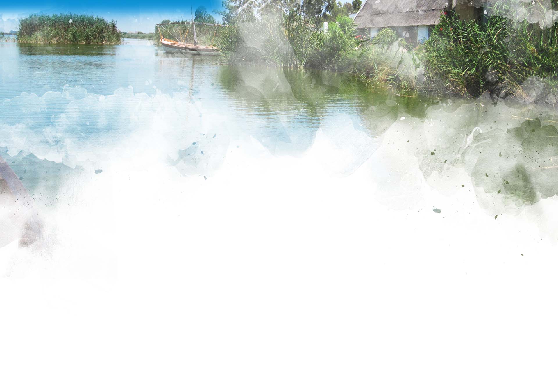
Each of the thirteen boroughs that make up the l'Albufera Natural Park have different characters: some still maintain their status as an agricultural-fishing area, such as El Palmar, Sueca or Pinedo; others prefer to engage in tourism, such as El Saler, El Perellonet or Cullera; while others count their industrial parks as a significant resource, such as Silla, Catarroja, Massanassa, Alfafar, and so forth.
All of them, however, are very attached to and fond of their Albufera.
21,000 hectares split among thirteen district boundaries!
Each one has their own history, their needs and interests as well as their own problems, future plans, and so on.
Get to know more about its peoples...
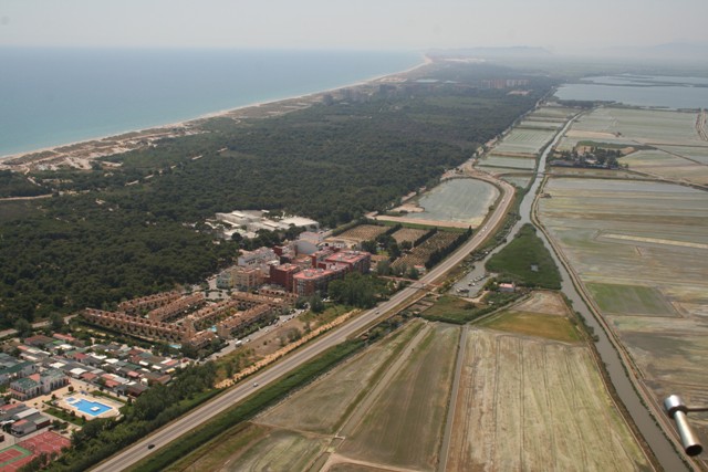
Pinedo
El Saler
El Palmar
El Perellonet
Pinedo
Trivia:
- It appears that its name makes reference to the pine grove that separated the beach from the marsh area. The earliest details about it as a population cluster date from the 19th century.
- In December 1963, some scuba divers found, submerged in the water on the beach of Pinedo a 1.45-cm high bronze statue that was named the "Apollo of Pinedo". On the roundabout at the entrance to the village we can see a replica of the sculpture. The original statue can be found at the Prehistoric Museum of Valencia (http://www.museuprehistoriavalencia.es/).
- This population cluster used to have a light two-wheeled carriage that used to take the Ravatxol route (mail boat) linking Ruzafa with El Saler, Pinedo, El Palmar and Catarroja.
- We can still see, at the entrance of this village, “La Genuina” cottage, dating from early 19th century.
- From Valencia there is a bicycle lane that begins at the City of Arts and Science and goes as far as Pinedo, across the estuary of the new course of the Turia River on a bridge that is to be used exclusively by cyclists. This bicycle lane continues south through the beach of l’Arbre del Gos going as far as El Saler.
- Pinedo have easy access and various services.
- Information and services of the beaches of Pinedo and l´Arbre del Gos. Press here.
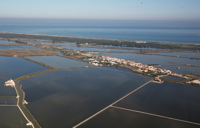
El Saler
Trivia:
- The salt that used to be extracted from the old saltworks located in the area currently known as “Racó de l’Olla”, was one of the main sources of income towards the royal property of the lake of l’Albufera. Its name, "El Saler", probably makes reference to the small grouping of cottages where this salt was stored before being transported to the city of Valencia.
- Of all the cottages that were part of the village, the best known were "Cubano" cottage and "Montoliu" cottages (knocked down in the late 1960's). In 1998, the last cottage to be knocked down was known by many as "Barraca del Cotero" or also "de la Tía Rosario", dating from the 18th century, which by then had remained uninhabited and become a complete wreck.
- San José dating from the early 20th century, it is worth noting the “Casa de la Demanà”, which has also been known as "de la campaneta" and dates from the 18th century. Up until the middle of past century, the entrance hall of this building held auctions to allocate hunting permits in l’Albufera, a practice that was traditionally known as Demanà. At present, it is the head office of the Youth Association of "Amics de la Casa de la Demanà" (www.saler21.com).
- In 1855, El Saler had just 39 residents and an inn. Nowadays, this Valencia district is renowned by its many establishments engaging in trade and hospitality.
- Before the construction of the current CV-500 motorway, El Saler was linked to l’Albufera and the marsh only by its port. At “Port del Saler” a fleet of boats used to carry goods and passengers to El Palmar, El Perelló, Catarroja, and so on. Nowadays, it can be accessed by going across the motorway by means of a runway which inevitably isolates it from the village.
- From the village, heading towards the sea, you will first see Colegio Luís Santangel where “El Piverot” stands out in its schoolyard. This is a huge stone pine tree specimen (which is about 175 years old). As you come closer to the beach, on your right you can see El Muntanyar de la Mona (a recreation area) and on the left is the Casa Forestal del Saler, which houses the offices of the municipal forest rangers.
- In the Devesa, among the pine trees, there are the remains of an old well, El Pouet which used to supply the village with drinking water, in addition to the well each cottage had, usually found in the yard.
El Palmar
Trivia:
- "An island covered with wild dwarf fan palm trees” is the origin behind the name El Palmar. These palm trees (margalló) are used by the residents of Torrent to make broomsticks: they collected the palms (leaves), dried and tied them and then trimmed them to make them look even.
- It appears that the original residents of the island of El Palmar came from the fishing village of Ruzafa, who gradually began moving to the island.
- In 1854, El Palmar had 65 cottages and one chapel, where 289 people lived. A fire in 1855 destroyed almost the entire village.
- In the 1930's, El Palmar was no longer an island since bridges were built over the leats of “Racó de l’Olla”, la “Nueva” and “Sequiota”, which connect it to the Nazaret-Oliva motorway.
- The cottages in Palmar were characterised by their rear part being round in shape which is why they were called “barraca de culata”. The rear of the cottage faced west where in winter blows a very strong wind called ponent.
- Even nowadays we can see navigating on the village canals what is known as barquets, or small vessels (about 5 metres long), with no keel, which are propelled by means of a perxa (or pole).
- The “lateen sail”, with its characteristic triangle shape, helped propel fishing boats, the barques d’arrós or càrrec (boats carrying rice) and barquetots or barca enterradora (boats carrying the soil needed to create new rice fields). This type of sail can be seen again nowadays on l’Albufera thanks to various organisations hoping to recover this as an art and as part of their heritage.
- Calafate is someone who culks wooden boats rendering them water-impervious, either by using synthetic products or, as before, by introducing between two wooden boards of the hull a combination of hemp fibre soaked in tar. This task must be carried out regularly on boats.
- The "Ravatxol" used to be a boat that carried people, goods and the post taking the route from the port of Catarroja to Palmar and from that point to Perelló. Initially, they used to be propelled by a lateen sail and later on by an engine.
- Although El Palmar is at present a village primarily dedicated to tourism and gastronomy, its status as a fishing village is still alive through the Community of Fishermen where every second Sunday in August they raffle off "redolins" (fixed places by means of collective fishing permits, preferably, which are raffled off every year).
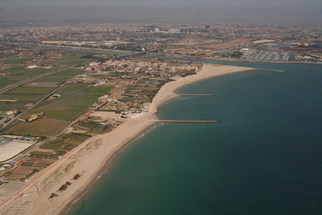
El Perellonet
Trivia:
- Its origins are linked to the construction, in the year 1903 to be precise, of the inlet of l'Albufera known as "Gola del Perellonet". The person in charge of the sluice gates and his family lived with the fishermen who lived in the small cottages built between the dunes and the rice fields.
- The construction of the Nazaret-Oliva motorway in the 1930's saw an increase in construction in the area, so up to 10 or 12 families settled next to Gola permanently.
- In the late 1940's, the Marquess of Valterra was granted property rights by the Naval Authorities over the land located south of the Gola where he had the fishing village of Perellonet built, which consists of 26 dwellings and a small church, founded in the year 1953.
- The construction boom of the 1960's and 1970's radically transformed the landscape from dunes and beaches to apartment blocks and single-family detached homes that can still be seen to this day.
- When driving along the Nazaret-Oliva motorway you may notice that El Perellonet is a village full of contrast: to one side, you can see a modern building cluster blocking the seaview, and, to the other, endless fields and gardens surrounded by oleanders and reeds that protect them from the sea-salt particles carried by the wind.
- Through the apartments you can see the remains of a fossil dune from the Holocene known as “Penyeta del Moro”. You may access it through Calle Hélice or la Calle Lluís Sánchez Polak “Tip”.
- Brotherhood of Fishermen of El Perellonet of Valencia. Calle de Sotavento, 18, 46012 Valencia 961 777 472.
Would you like to know more? Check the table of boroughs
Table of municipalities
If you want more information, go to: